ART 10D - 2D FOUNDATION
Big Project 3 - Mapping Narratives


Introduction - Maps + Information
As we have discussed throughout the quarter, 2D artworks of many forms help us describe and understand our world. Artists and designers use 2D artworks to communicate information to viewers, often in the form of a narrative, or story. We see these stories presented through photographs, drawings, paintings, symbols or typographic designs, where the visual properties, subjects and other creative choices all combine and influence meaning.
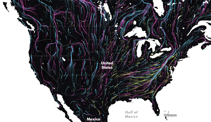
Maps present a unique set of visual symbols that can communicate large amounts of data and information simply and effectively. These images can show geographic data such as boundaries, locations, elevations and physical features (both natural and human-made). They can show density, population, frequency and paths of travel or migration, and can be used for way-finding or other location-based information. All of this information tells a story of some type - most commonly we see this information presented straightforwardly, and we tend to think about maps as practical tools and components of geographic science.


Expressive Potential
Maps, however, are also incredibly expressive, and can be used to tell a variety of stories and information beyond location and geography.


Expressive Forms
The design and visual language of maps can also be explored and adjusted to influence meaning, emphasize some information, and/or shape a story. This can include ideas such as re-drawing boundaries, changing the scale of known features, or repositioning / relocating known locations. This can also involve adjusting or abstracting known symbols, introducing new systems of mapping language that resemble existing forms, or replacing symbols with completely unrelated images. This exploration is not required for this project, but can be a very compelling direction to work with.


Project 3 Description
For Big Project #3, you will use the basic visual language of maps and mapping to tell a story with some type of personal connection. This story can be about something from your own life or a family member or friend. It can be about a community, large or small. It can be about an event or movement (social, political and/or environmental) that you care about and want to explore further. The map itself can be straightforward or abstracted. Maps DO NOT need to be “accurate”, just be sure to be intentional with the level of accuracy or detail you decide to work with.


